Ben Alder Speed Climbing Attempt
Recently, I’ve been searching for a challenge which would really test me, force me to push a few limits, and take me back a little way to a particular test I’ve dealt with on some Himalayan mountains, namely, self-reliance. To be able to look after yourself in challenging situations is both satisfying and rewarding, but I wanted to find somewhere I could push myself within the confines of Scotland. Scotland isn’t the most remote place in the world – this is evident from the availability of Google Street View throughout the country, but I just so happened to spot a particularly remote mountain while perusing an ordinance survey map earlier this year.
Ben Alder at first glance looks to be an easy to reach Munro, but having a closer look reveals it’s one of the most remote mountains in Scotland. There are three roads which triangulate the mountain, but they are all around 10 miles away and lurking behind other mountain ranges. At 1,148m in elevation, Ben Alder is interestingly, albeit slightly irrelevantly, home to one of the highest bodies of standing water in the UK.
After doing a little research, it became clear that to my knowledge, no one has yet climbed Ben Alder in a single day on foot, and the only realistic way to do it in a day was to either take a bike, or get permission to drive up one of the various tracks dotted around the mountain. But then the little spark went off, and I realised the challenge that could be had: would it be possible to park the car on one of the 3 public roads near the mountain, and then climb Ben Alder and return to the car in a single day? This would have to be without the use of a bike, and without driving down any tracks which may have varying permissions depending on the land owner.
To put this in perspective, here is an overview of the area surrounding Ben Alder. The map below shows Ben Alder circled in the middle, the main roads surrounding the mountain in red, and the 3 main routes to the mountain in green. Each route is around 10-12 miles in length, and for scale, the loch to the east of Ben Alder is 14.5 miles long (Loch Ericht).
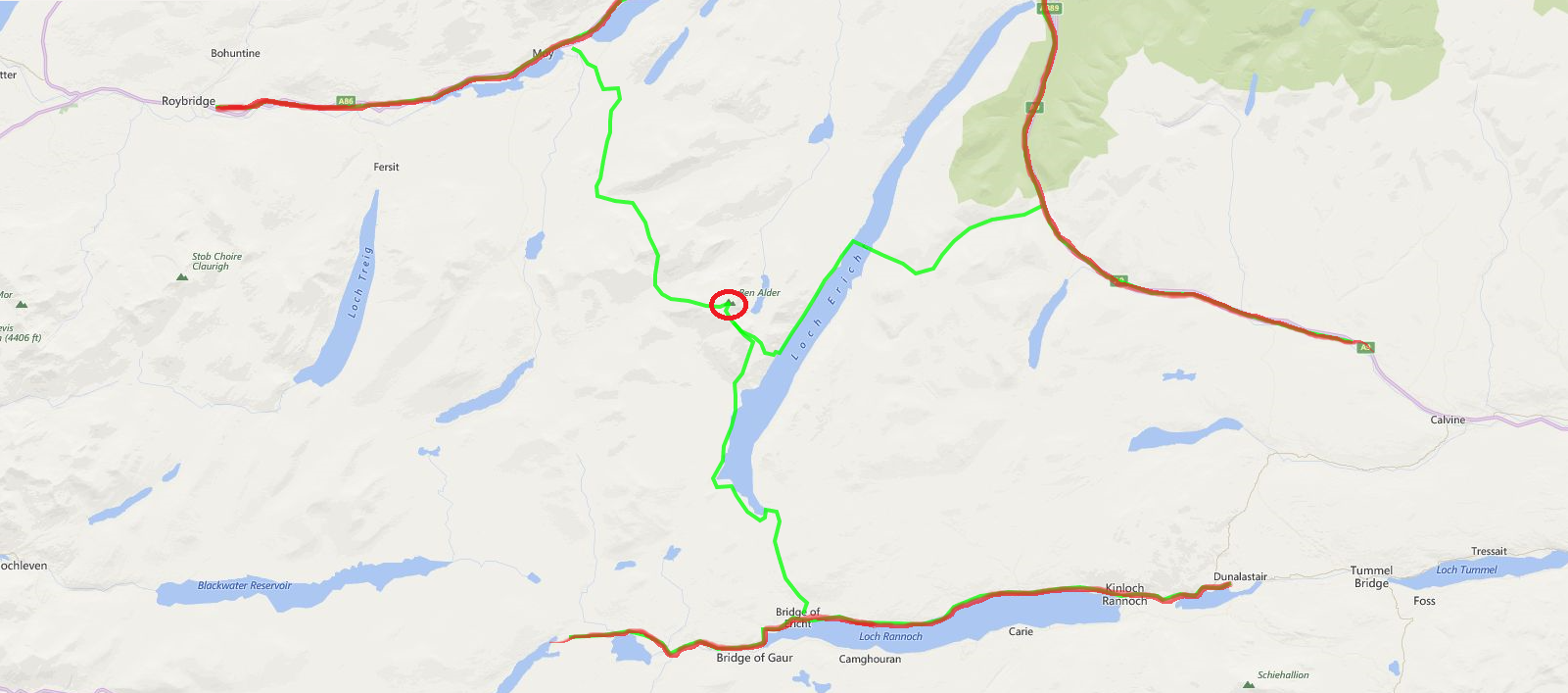
To find out if it would be possible to complete any of the routes in a single day on foot, I would first have to choose the best route. I ruled out the route to the North West from Moy due to the multiple mountains between the road and Ben Alder. The route to the South was the longest, and actually looked quite boring. It may have potentially been the quickest route, but it was essentially walking along a river then a loch for hours and hours, before ascending the hill, then returning back to the car.
The route I opted for was from the North East (from Drumochter Summit on the A9). It was the shortest route, but it had an obstacle which I assumed put most people off from taking this route, mainly Loch Ericht. I’m still not entirely sure whether anyone has ever climbed Ben Alder from the A9 in any number of days.
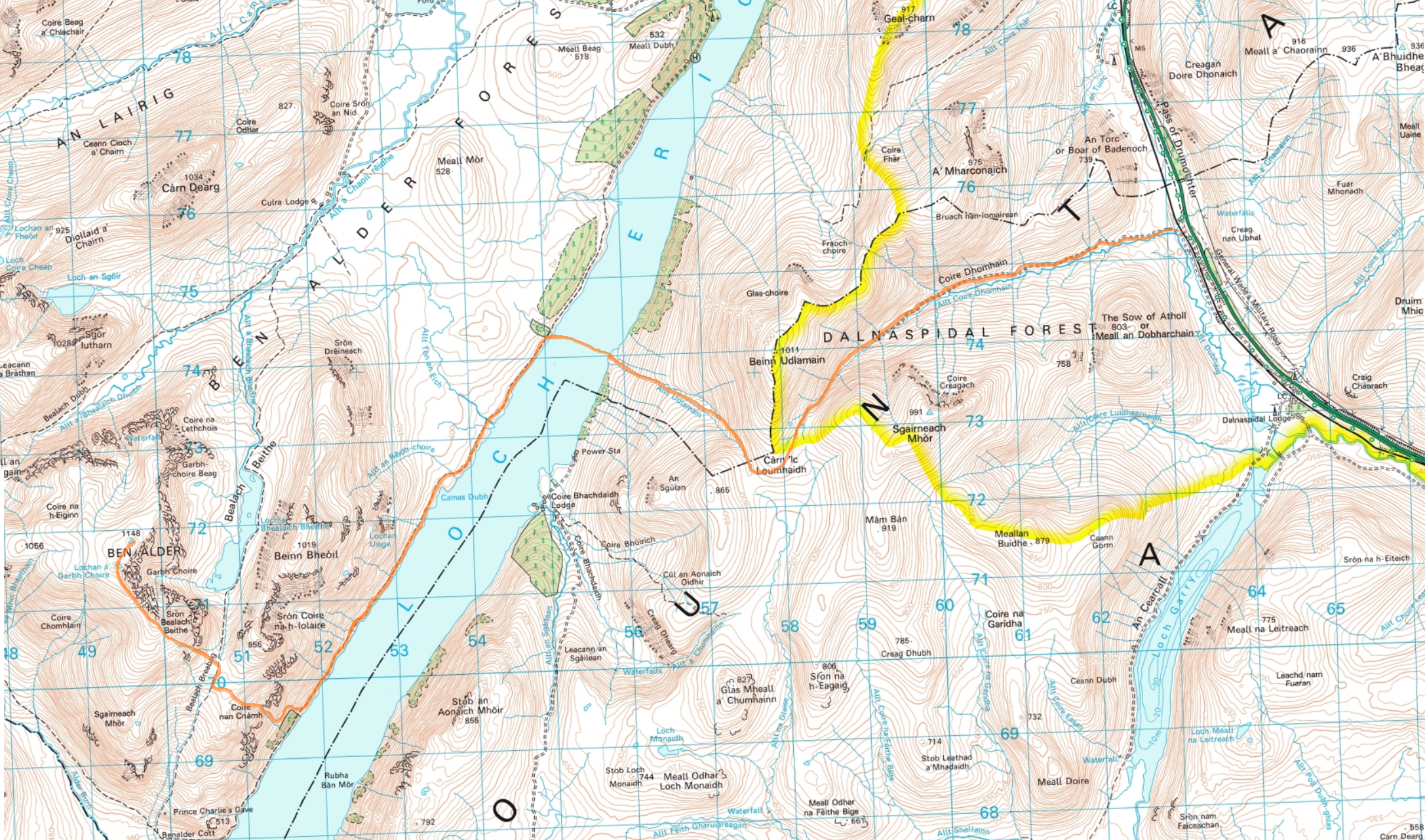
With my route chosen, I started to plan things in a little more detail with an Ordinance Survey map. From the map below, I decided I would park at the A9 and walk along the track through the Dalnaspidal Forest, which had decidedly few trees; none in fact. From there it would be a simple case of walking up to the col, down to the loch, somehow cross the 1km wide, 150m deep loch, walking for 5km along the other side of the loch, then climb up the side of Beinn Bheoil, before taking on the final slopes up to Ben Alder. This would be about 10 or 12 miles of walking one way, and I assumed I could possibly reach the summit in 6 or 7 hours. Of course the return journey would have a lot more downhill, so I could complete this in a spritely 5 hours.
In truth, I didn’t actually know if any of the route would be possible, and even if it was, I had no idea how long any of it would take.
The 4th June (2016) looked to be a perfect day for the attempt. A cool morning, but then good weather throughout the day. I packed on the Wednesday beforehand, making a list of all the food I would need to buy on the way.
During packing, I was feeling cautiously pessimistic, and so the first item I put in was a sleeping bag (which seemed to defeat the point of trying to do the climb in a single day). In reality, this would be left behind as a carrot to walk quickly back towards. I packed two rucksacks. The first was a 65L ski touring bag. In it, I would talk 4L of water, food with many thousands of calories, a hat, gloves, water proofs, belay jacket, GPS, a small running bag, and crucially a boat. Well, an inflatable dinghy, commonly called a pack raft, to be precise. I knew that the best way to tackle Ben Alder would be to first take all my kit to the loch. So for 2.5 hours, I slogged up the hillside through the non-existent forest, and into the clouds. I started the walk at 6:30am, and since it is a Scottish summer, I wouldn’t have to worry about darkness unless I happened to still be walking at 1am the next day, when it would be slightly dusky.
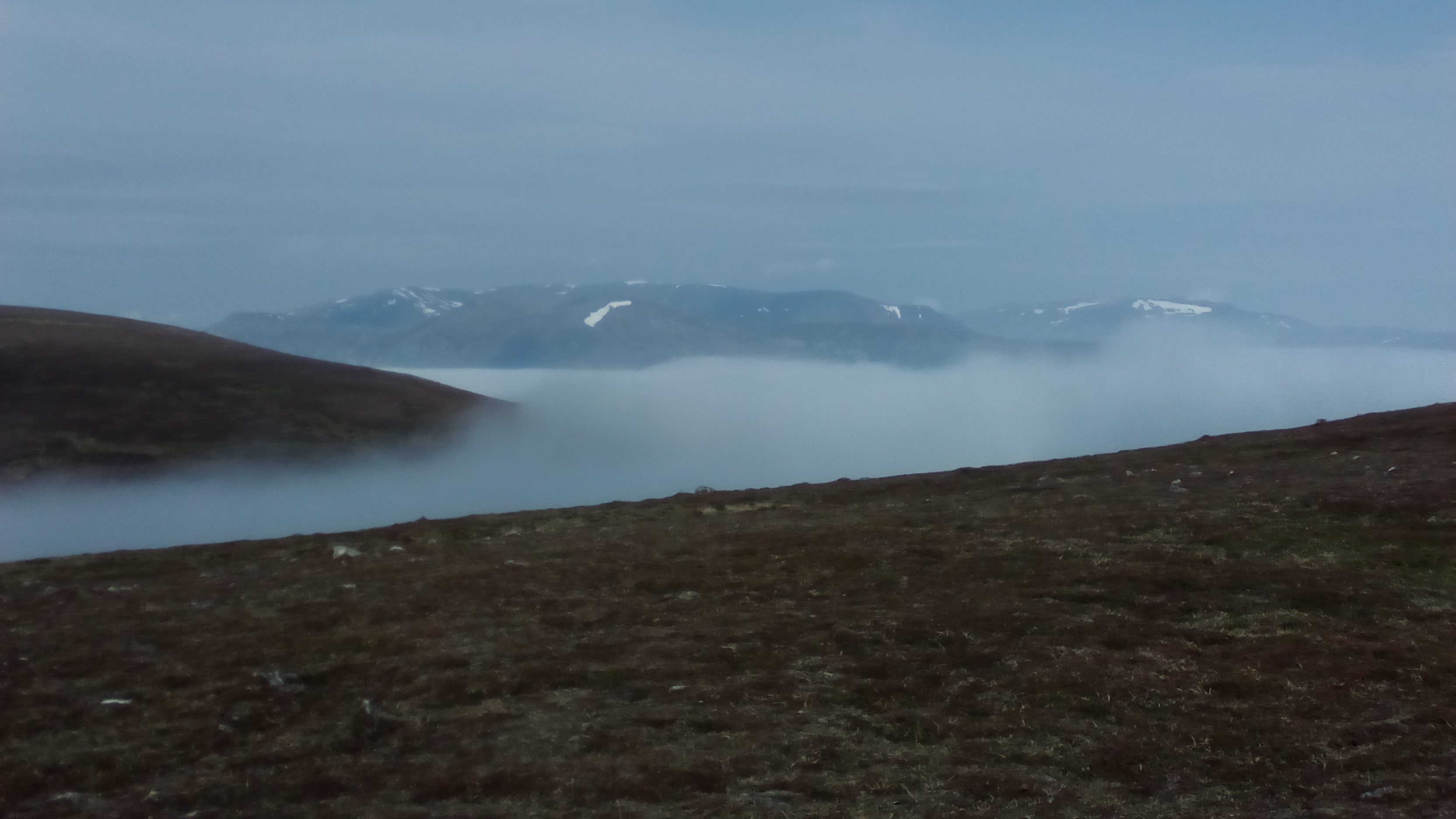
After 2 hours of walking I reached the top of the col, and for the first time, emerged through a cloud inversion and basked a little in the sun. Then I took a glance over to my left, and started to feel a little sick. The loch was some way down in the mist, so I didn’t have a scale, but I saw Ben Alder for the first time, looming away in the distance, a distance which could have easily been 20 or 30 miles away (the furthest mountain away, just left of centre in the image below).
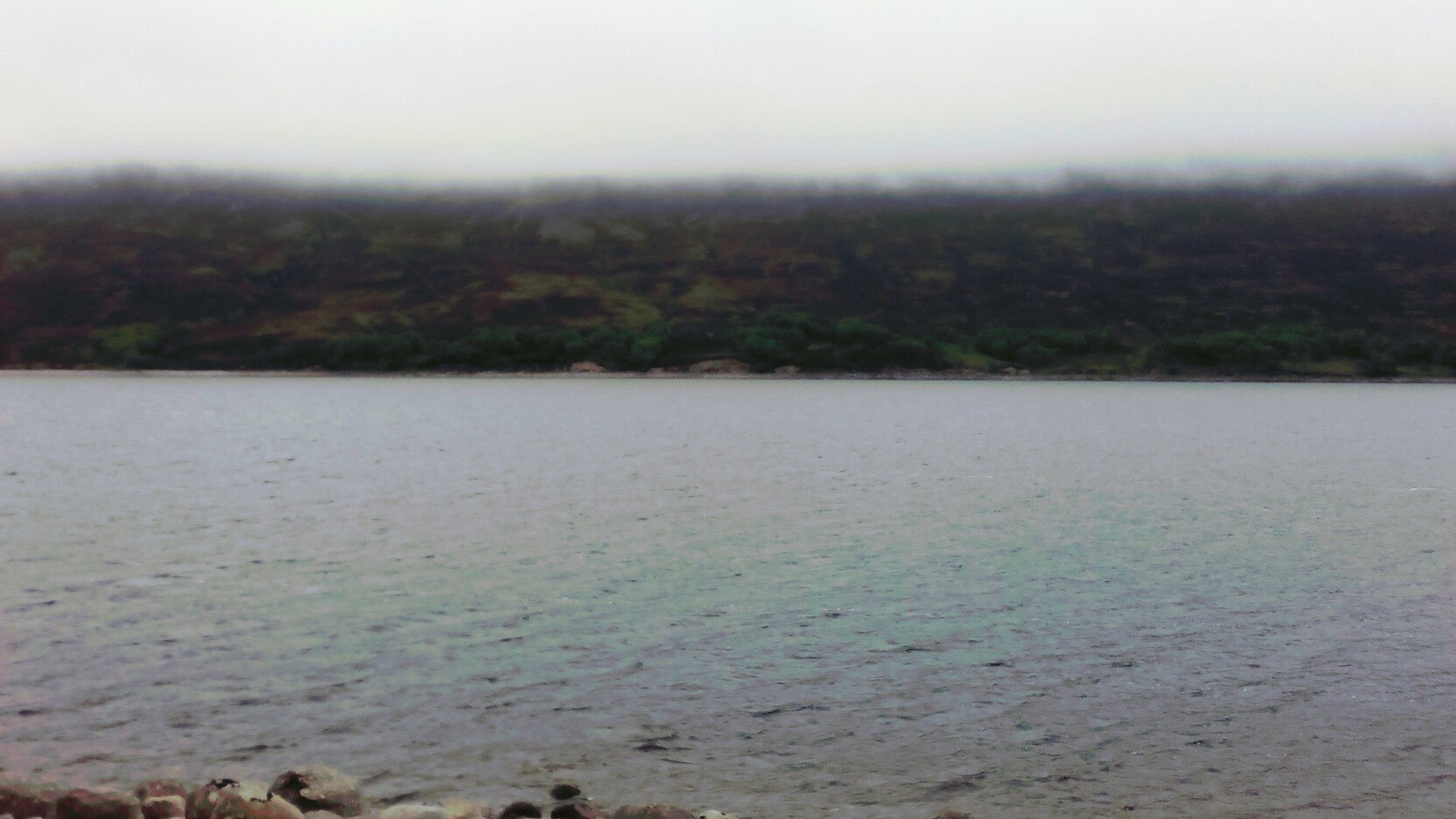
I tried not to think about that, and instead, descended back into the clouds towards Loch Ericht. After 2.5 hours (9am), I reached the shores of Loch Ericht, and got to work pumping up the inflatable. I’d previously taken it on the rapids of the River Dee (https://www.youtube.com/watch?v=EC7h8N3yuxM), but had never previously crossed a loch before, or even any notable stretch of extended water. Getting in to the loch, I had a fair amount of apprehension, and it wasn’t until I got to the middle and looked down the length of the loch that I realised exactly what I was doing. The area I was in was practically uninhabited, and so if anything went wrong, I was on my own, I had to get myself out of the situation, and if that meant giving myself an enema Bear Grylls style to stay alive, so be it.
Fortunately, I got across relatively choppy waters, and then got ready for the third phase of the climb. This meant leaving the boat by the water’s edge along with my heavy rucksack of water and warm clothing. I replaced the big rucksack with a small running bag, 2L of water, a coat, gloves, a GPS and some food, and then headed on the path along the side of the loch. I felt the gear stash was a great idea for keeping the speed up and maintaining good progress, as there wasn’t any real need to take anything else. I would describe what I took with me in terms of kit as minimal. Literally the bare essentials I would need which would act as a safety net by allowing me to go quicker rather than forcing me to spend the night out under the boat/stars.
By 11am, I reached the base of the climb. I had been traveling for 4.5 hours, and my time schedule was no longer existent. I still didn’t know if I would make it to the summit in the day, so I set myself the turnaround time of 12:30 or 1pm depending on how I felt. Even on a 1:25000 Ordinance Survey map, there are no paths to the summit of Ben Alder, so I improvised by climbing up a steep, mostly dry waterfall to the col where Ben Alder joins Beinn Bheoil. At this point I frightened a small herd of deer, and then frightened myself when I came across not one but 3 human beings collecting water in their own attempt to climb Ben Alder. They choked a little when I said I’d walked from the A9.
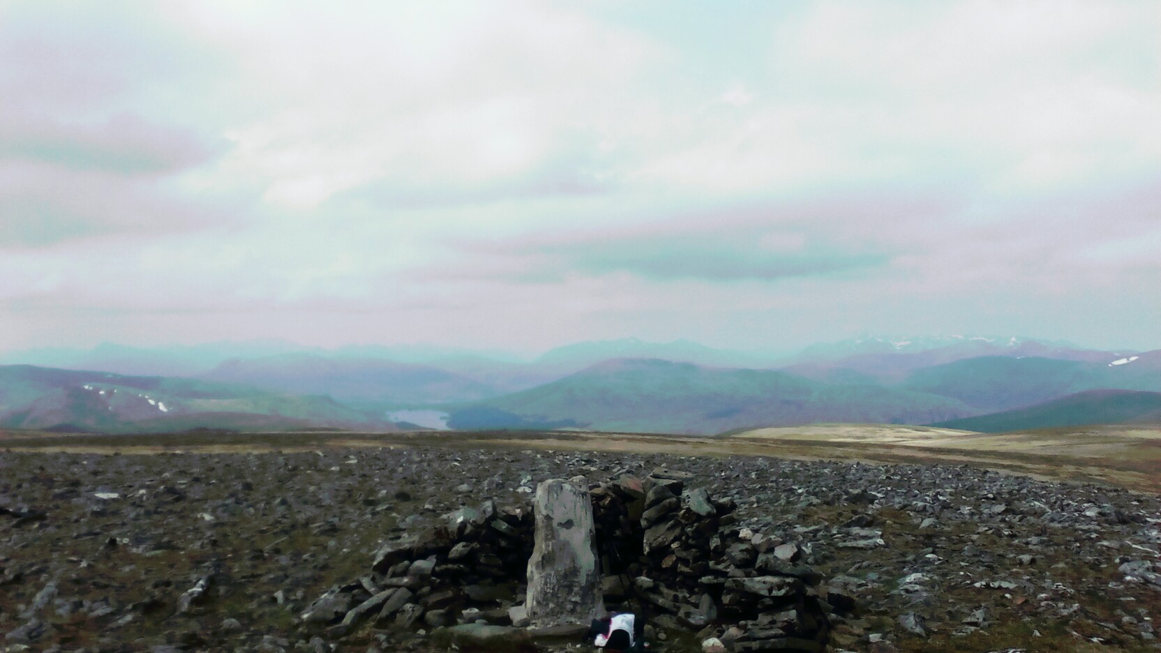
Even when I reached about 1000m, I still didn’t know if I would make it. The summit plateau was over a kilometre in length and it wasn’t until 12:20 (5 hours 50 minutes after leaving) that I finally reached the summit. As this point, I took a quick few photos, and then tried to decide on the best way back. It is hard to stress the self-reliance demands in a situation like this, where you are now at the furthest point away from safety which is located somewhere behind two mountain ranges. Since no one has previously documented any attempts, I had nothing to go by. I wasn’t sure if it would be best to descend to the North of Ben Alder or attempt to descend via the steep waterfall I had come up. This was a key decision to make since there was now the prospect that this route was going to take the best part of 12 hours or more, and I still had to re-cross the loch and climb back over the first mountain range.
With no one to ask, I did a quick self-assessment, determined I still felt I had enough energy at this point to complete the trip, and then decided to descend via the waterfall based on the fact that I could always bum slide down the grassy slopes to the side if necessary.
A further long slog occurred, and it wasn’t until around 3pm that I made it back to my inflatable which had slightly depressurised in the afternoon sun. I didn’t waste time in topping up the air, and so got straight back into the loch with slightly bigger waves than before, and tried not to think about the 150m of blackness below me.
Upon getting back to the other side, I realised that for the first time, I could probably complete the challenge, but since I had already been moving for around 9 hours, I would be looking at a total of 12 or 13 hours car-to-car by the time I managed to get over the final mountain range of the day. At the top, I finished my last drop from an original 4L of water (which I thought was impressive), and then plodded on for the remainder of the journey with the A9 in sight nearly all the way.
It took me 12 hours 39 minutes to complete this little challenge, and I believe I’m the only person to complete Ben Alder in a single day, on foot from the nearest road. I’m ignoring the boat in this since it was 10 times harder and 10 times slower than walking the same distance…
Physically, despite not being able to easily walk today (the day after), I didn’t find the day too taxing, save for the final climb which was in 28 degree Celsius heat. What was truly taxing, and made this challenge easily one of the hardest things I’ve done however, was the psychological challenge. The challenge of being along, making decisions, and actually not ever knowing if you will be successful until you’re physically standing on the summit or back next to the car (having dropped your keys in the loch). The energy required to constantly be checking the weather, assessing the bad route you’ve chosen, or debating if you’ve got enough water for a round trip is what separates this challenge from all the super hard physical challenges I’ve had.
With most professional sport, it’s comforting to know that at the end of the day, no matter how much energy you’ve expended, and no matter how exhausted you are, you’ll finish up sitting comfortably, either in a car or the back of an ambulance. But in the mountains there are so many more possibilities.
For those interested in the route I took, I manage to track the route via GPS which you can see here: https://connect.garmin.com/modern/activity/1198710622
And as a closing remark, I would implore you to go and explore this remote corner of Scotland. Despite the psychological challenges, there really is nothing more refreshing than standing on a big hill, no matter how you have got there, taking in the 360 degree view, and not seeing single person for as far as the eye can see.
#MattAlder