The Flare Line Review
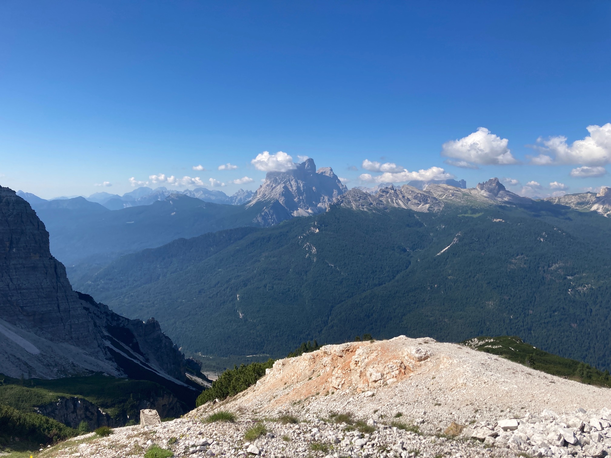
For me, this summer was spent in The Alps with occasional climbing but mostly a balance between running and flying. Despite having flown paragliders in various guises since 2014, 2023 has marked a high point with more flights than any year previous and a lot more variation. I’ve not flown paramotors this year, but I managed to fly a good deal of speed and paragliding with some run & fly to keep the fitness up.
I had some great flights on my Swing Mirage RS+ 7m, did a lot of ski slope proximity flying on the Flare Moustache 13, the Skyman Speed 15 was taken up a few mountains and the Phi Maestro 2 Light was a great antidote after heavy days with a lot of speed.
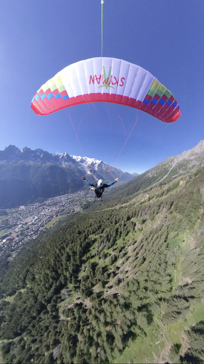
There was one wing that I flew however which was simply breathtaking. In the summer of 2023 I did my first flights on the Moustache 13 (so I was a relatively late adopter to the Flare way of flying) but at the same time I was also given a tiny prototype wing that Flare were working on, now called the Flare Line. After a couple of days flying around on the ‘old news’ Moustache, I found myself in Mürren on top of an 800m cliff contemplating whether to become one of the extremely early adopters of the Flare Line 9m. I was absolutely terrified.
To give this a little more context, the smallest wing I’ve regularly flown is a 7m speedwing, the Swing Mirage RS+ comp. This is one of the fastest speedwings you can fly with an incredible dive which feels like going from a gentle glide to simply falling out of the sky. So I’ve had some experience flying comparatively very small wings in the paragliding world and should have an idea how to tackle this new wing.
The thing is, I’m not a test pilot and had never flown a prototype wing before. I also knew a few of the scary details but none of the ‘oh it’s actually fine’ details, so that made the very first launch above Mürren somewhat traumatic. I walked quite high above the village for the first launch so as not to fly straight into the cable car…
The Flare Line 9m
This review is intended for those pilots who speedfly to get an idea of what the small version of the Line is about. I’ve not flown the 8m, 11m (or 13m/15m) versions, nor have I flown it in strong winds so this is primarily aimed at the proximity speedflying pilots.
The 9m version of the Line is in my view equivalent to a ~6m speedwing in dive and an ~11m speedwing in glide when flying at 65-70kgs. That’s to say it dives very steeply AND glides exceptionally well. This performance has never been seen before in speedflying. It’s also something I never thought I’d see in speedflying or enjoy since NEO’s Steep Active System (S.A.S) didn’t exactly take off. Well I was wrong!
There is a catch however which I will come back to: speed.
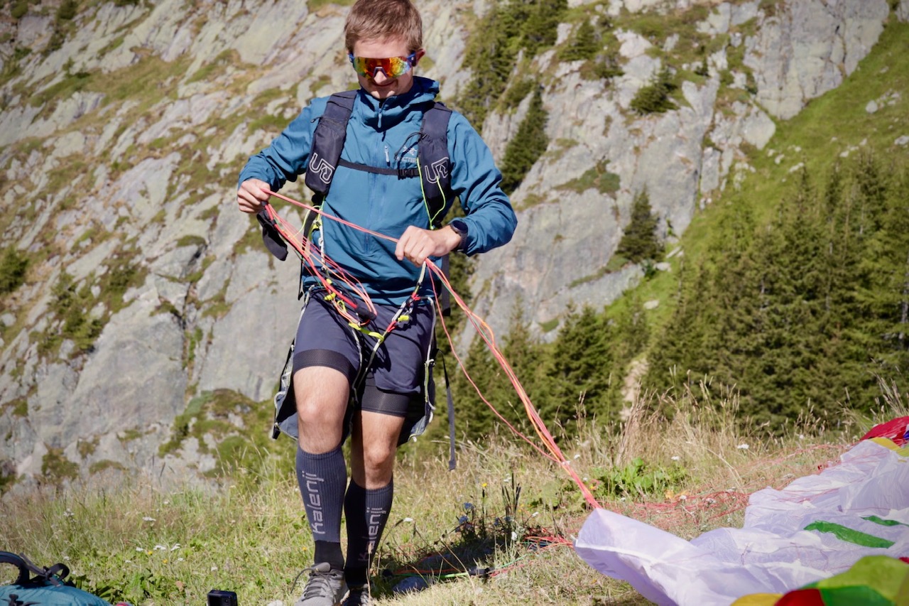
Ground Handling & Launch
While the Line is relatively easy to play with on the ground you never really get a feel for how it flies, particularly in the 9m size. The riser system is the same as that on the Moustache so full hands up is equivalent to trims fully open, and hands down somewhere near the L&R tabs is trims closed. When ground handling in strong winds even with the hands down, you don’t really get any lift in the same way you might if ground handling a Spitfire. You get the idea of what might happen, but it’s not very comforting until you actually start to run downhill.
Flare tell people to launch the Line with all the risers over the arms like a modern speedwing but I actually prefer to launch by holding the base of the A riser. This seemed to work better in my view when forward launching as long as you’re ready to catch the shoot and run. Beware – When reverse launching the 9m in strong winds, it will overshoot very hard and immediately frontal, i.e. nothing like the Moustache. In this instance it’s definitely better to launch with the cobra technique, or forward launch without holding any riser and immediately run as fast as possible.
This is also a good time to mention a launch habit that a lot of pilots seem to have. When launching especially in nil wind or a slight tail wind it’s important to catch the shoot of course, but on any Flare wing it’s very important to then run fast with the hands up. The higher you get your hands at the running phase, the more energy you have access to on the brakes. Even experienced pilots seem to easily stall Flare wings on launch by running with very deep brakes. That position works on a paraglider but with the Flare risers, full speed is a much higher hand position.
For my first launch on the Line 9m, the wing came up fine and using the technique described above the launch was actually very comfortable. I’m used to foot launching a 7m speedwing so that certainly helps, but the Line launches much more easily. If you keep your hands high, you have so much energy to access straight after launch. Essentially, if you give this wing the same respect you’d give when launching a 9m speedwing you should have no trouble.
Initial Observations
When you first fly the Flare Line, three things become immediately obvious. The first is the energy in the brakes. No other wing comes close to the amount of power you have when pulling down the toggles. Second is the speed. More on this later, but it’s clear almost immediately on takeoff that the landing field will need to be huge. Third is the rush. When you first take the Line high, you might pull a big 360 to see what happens. If you’re used to small speedwings you would expect to just dive down as normal but on the Line, the rush (g-force) is beyond anything you would expect. The reason for this is again the speed.
The Line Rush
When you first learn spirals on a big paraglider, you go slowly because it’s hard to take the amount of energy (g-force) that quickly builds up and feels like a rush. The reason for this isn’t the speed so much as the long lines, meaning you are spinning a long way from the wing. This pendulum effect pushes all the blood to the feet and gives you the light headed/narrow vision associated with approaching g-LOC. This doesn’t happen so much with speedwings, you can do even slow spirals easily with little-to-no g-force effects. Yet on the Line for some reason I found that any slow diving manoeuvres had quite a marked rush effect. I don’t know 100% why this is, but I guess it has something to do with slightly longer lines than an equivalent speedwing and the massive increase in speed. It’s manageable but is something to be aware of, and you should build up the swooping dives slowly if you’re not coming from such a fast wing.
Flying Technique
In terms of physically flying the Line, I would say that it is like flying a Moustache 13m but everything is incredibly amplified. Once you are used to the speed, the same physical motions are used to control the Line as you would a Moustache which means the same micro-pumping technique is very effective for tracking the ground. With any Flare wing, once you reach a very low altitude above the ground you can maintain this even if the ground starts getting steeper by adding some small inputs symmetrically. This forces the wing to use up some energy by climbing, meaning after the climb you sink to a lower level than before to regain the lost energy. It’s not a technique I really see or use in regular speedflying, mostly you can just pop-up and add a roll to lose height quickly, but the mico-pumping technique seems to work really well on the Flare system in the absence of snappy rolls.
The Size, Glide & Dive
As I said above, the Line 9m glides like a good 11m speedwing (i.e. Mirage) at a TOW of around 70kg. If you’re heavier, i.e. around 80-85kgs, I imagine best glide would be worse, equivalent to maybe a 10m high AR speedwing. Gliding on the Line is a very strange feeling. You can pull the brakes very deeply for best glide and the glide becomes noticeably very flat. It’s an unfamiliar sensation for two reasons, firstly you just can’t glide that well on any other small wing, and secondly you’re still travelling incredibly fast even with the brakes so low.
The dive on the Line is equally odd but for different reasons. As above I think it dives like a 6m speedwing, i.e. very deeply when you’re high above the ground and put in a big turn with hands fully up. The strange part is that when you are flying straight at best glide and then put your hands immediately up, you don’t drop out of the sky like you might expect. To me hands up feels very similar to the first 2 seconds after you exit a barrel roll on a normal small speedwing. It’s very fast but doesn’t feel overly steep. For example on the Line 9m if you want to proximity fly down a red piste you regularly need to go fully hands up to track the terrain. So it’s not like you could track anything really steep like a black piste and expect to be able to follow the terrain with only full speed – you would certainly need some aggressive turns or to roll, something that I think can be quite difficult if you were flying very low, as I’ll mention later.
Hand Position
To access this glide and dive, I found that you can’t position your hands the same way as you would on a Moustache. For the Moustache 13, I hold the toggles with my middle finger. You don’t need very much strength at all so this is very easy to do and it also means you can reach full speed without over stretching.
This doesn’t work on the Line because of how deep you need to pull the brakes when landing. The travel on the Line is much more than the Moustache; best glide is where you pull low enough to start engaging the brake line which feels nearly down to the carabiners. A full wrap like when flying a speedwing also doesn’t work because it becomes hard to access full speed for a long time. To solve the issue I found holding the inside of the toggle loop right under the acro t-bar worked well giving full speed but also plenty of flare for landing. For those thinking they could just change up the hand position in flight, I would be super careful doing this. In the worst case scenario you drop one toggle as you change position but the other toggle stays down at best glide, you’re going to go into a full dive on one side which would burn a lot of altitude.
Flare for Days
The Flare! I’m not going to write too much about the flare of this wing, partly because it’s incredible and words wouldn’t do it justice, but also because the flare actually contributes a lot to the challenges of the wing. All I can say is that if you try the Line 9m, you’ll be blown away by the flare even with relatively little energy build up beforehand. The 11m and 13m Lines will surely be equally miraculous.
Weaknesses? & Challenges
Speed
To be fair the speed of the Line isn’t a weakness but it’s definitely one of the challenges, particularly in combination with the flare. I would suggest that to fly the Line you should be able to speedfly a wing at least 2m smaller to have any idea how how to control speed in the air and along the ground.
As previously stated the flare is incredible, it just glides and glides when landing even without too much technical swooping knowhow. The issue however is that this is surely one of the fastest (if not the fastest) foot launchable wings out there, so the swoop takes place over incredibly long distances. To explain this better I’ll use two other wings as examples – a 7m Mirage, and a 5.7m Rapido 3X.
When flying the 7m Mirage, you can comfortably land within 100m, maybe 80m at a push. You can also make the landing about 150m if you make some spiral dives and swoop the landing field. In Lauterbrunnen, I met up with Joey Innes who flies the 5.7m Rapido 3X, a truly tiny wing when seen in person. After doing three or four super aggressive spirals, the flare was only around 120-140m in distance.
How does this compare with the Line 9m? I struggled on my first couple of landings with the Line. The speed was far more than I was used to, so I took things as easy as possible. On my third flight, I didn’t do any turns, instead just controlling my approach with the pitch. The flare on this landing was 150m, 10-20% longer than the 5.7m Rapido 3X, without a single turn.
The following day I took the wing to Lenk: a great place to test proximity and with a big enough landing for some gentle swooping. The shortest landing I had that day was around 140m with the longest being about 160m. I’m sure after a month of flying the 9m you could get to 200m. And that is the issue because in some places like Les Deux Alpes, the landing is only around 120m long. Even Chamonix’s biggest landing field is only 160m long unless you take a last minute turn through the trees.
This flare on landing is clearly a challenge but it’s also a huge positive for pilots used to small wings. It’s a common occurance to stall a small speedwing when landing – trying to land a speedwing smaller than 9m with trims closed is a recipe for this. From my flights on the Line it’s clear that the stall speed is very slow and even in nil wind you can often land at a fast jog instead of a sprint. It’s actually surprisingly hard to stall the 9m Line on landing so I guess the 11m would be good in that regard for a lot of pilots who haven’t flown the smaller speedwings yet.
Fences!
The Line isn’t like any other wing you’ve flown, in the smallest sizes it’s the fastest most scary thing you can reasonably foot launch. Paying careful attention to electric fences and the usual hazards that you get on mountains is so important. You’re going so fast that you can’t expect to see every fence or obstacle in the long grass ahead, so do some high passes over your chosen line first before you decided to fly at ground level and pay really close attention to anything that you might get snagged in.
Barrel Rolls & Riding
The Moustache wasn’t built as a speedwing so understandably it isn’t a wing you would want to barrel roll very close to the ground. In flying the Line 9m, I’d say that this characteristic is definitely improved. In the smallest size the Line is incredibly rolly. I’m still not sure it’s as snappy or direct as something like an Ozone R3, but from what I’ve seen it definitely barrels well. I’m interested to see what other pilots do with the 9m Line, but I get the feeling that it lies somewhere between the Moustache and a speedwing, certainly closer to the speedwing but not exactly. I feel like this is more of a wing where you can be higher up on the line and do a slow roll into it, but then use the pitch control in the toggles to maintain altitude, rather than just endlessly rolling down a slope. I’m sure consistent snappy rolls are possible but I think you really need to dial in your toggle usage so you know exactly where in the long range of travel you start and end the roll.
For that reason I don’t imagine this would be the easiest wing to fly in cracks or close gullys, but more of an open slope machine that sticks to everything but the steepest ground. I’ve only tested the prototype and this review is being written before any official details of the wing are made public so I wouldn’t be totally surprised if the launch video features a pro flying it down a super steep and narrow crack.
Equally, this isn’t going to replace a speedriding wing, not least because of the speed and flare risers. Given that this is one of the fastest wings, I’d imagine that regaining the snow with the Line 9m and even 11m would be a challenge if you didn’t have a long and gentle slope. It’s not something you would choose for riding on steep or twisting terrain. It’s not just the speed though, I’ve not ridden with the Line but I’d guess that it wouldn’t enjoy low speed unloaded riding where you also ask the wing to track you around tight turns. For pure French style speedriding with lots of slope contact time, any other dedicated speedwing would be a better bet.
One last thought on rolling – when flying the 9m I didn’t actually feel much need to roll. I was enjoying the pitch control so much with this wing that for once it was actually enjoyable not to pop up and roll to get back down to terrain. If you really enjoy rolling, you might find it strange that you had so much fun just tracking the terrain, you didn’t even think to add any barrels.
Usage & Sizing
Stability
One thing I haven’t yet mentioned is how stable the wing is, i.e. how does it actually fly in moving air, is it twitchy or nerve wracking in any way? Firstly it’s important to note that any wing can collapse and if you collapse something as small as a 9m speedwing regardless of the special profile or any reflex, the reactions will probably be quite violent. Potentially fine if you’re up high but I wouldn’t recommend flying any small wing in heavy turbulence. With that said, I flew the Line on a couple of thermic days with some conditions that wouldn’t be super fun on a normal speedwing and actually the Line felt solid. I don’t know whether the additional brake travel means you can more effectively active pilot but it really does feel like a solid wing to fly. I wouldn’t recommend going hands up through really rough air, but as soon as you go to best glide it seems fine. I was at least as confident as on my Mirage RS+.
So that brings us to what this wing would be best for. Bear in mind that this is only a personal opinion and I will also be using a speedflying & speedriding wing which might influence times where I don’t use the Line. I would also suggest to those looking at Flare wings that a Moustache 18m (depending on TOW) and a Line 9m, 10m or 11m (depending on experience) would be the best options in the Flare range. I think unless you’re doing regular high wind soaring, a Line wing takes away the need for a Moustache 13m and the Moustache 18m is far more versatile than the 15m at 70-80kg.
Summer Ski Slopes
I think the Line wings excel in the same spots as the Moustache 13m with the advantage that they can fly steeper with only a slightly steeper launch (and longer landing). If you frequent ski resorts in the summer, the Line wings are perfect because they can track all but the steepest pistes.
Lenk is a great example of a ski resort which in summer is too shallow for very small speedwings because the various launches aren’t too steep and there are long flatter sections down the mountain. Despite this, the Moustache 13 doesn’t feel dynamic enough for these pistes – the Line is much more nimble and carving turns lose more height so you stay near the terrain far more easily.
Big Mountain Flying
I would also seriously consider the Line for big mountain flights. The Line has a good tolerance for higher wind launches (if you use the cobra technique), launches well in nil wind and has a much better glide when needed than a traditional speed wing. This is often needed on big mountain flights to cross flatter terrain such as glaciers or escape a forested area before landing. A good example would be flying from Mont Blanc to the North. You could easily launch, then do a huge spiral down the north face before roughly following the Grands Mulets route which in places can be quite flat (i.e. le Grand Plateau). Just a final note on packing size, the prototype version has plastic rods running down the middle of the wing similar to some EN C/D Paragliders. While this does hinder super tight packing sizes (an R3X 5.7 is roughly 1/3 the size of a Line 9m when loosely packed) the wing still packs small as you’d expect for a 9m wing. This might be something to think about if you’re very tight on space, if you can only just squeeze an R3X 9 in your bag, the Line 9 might be a struggle.
Windy & Smaller Hills
Somewhere else where the Line would be a fantastic choice is in windier places with smaller hills. The Line copes well with strong winds thanks to the Flare DNA, but it also would make many of the hills in the UK for example much better for speedflying because of that additional glide. Often pilots need to land in the middle of the mountains because the flat sections are just too long to overcome on a normal speedwing. Additionally, if the landing was short I would prefer a normal speedwing however if you had plenty of space but it was uneven and rocky, the Line would definitely be a better choice. Despite the initial landing speed it slows down more than a speedwing eventually and even on the 9m you can finish the flare at a fast walking pace with enough initial energy.
Wing for Travelling & Unknown Lines
The previous examples are quite specific, but I think there is one place that the Line would be better than any other speedwing. That is as a general all purpose travelling wing. This isn’t to say that you need to go travelling with it but more that I can’t think of another wing that would be better suited to a mix of known and unknown lines. For example, if you regularly fly the same very steep spot and don’t plan to change, stick with a classic speedwing. If however you like to fly lots of different lines and go to new places the Line would be perfect. It minimises the “is this section steep enough for my speedwing” question, and also removes the question “is this line too steep for my Moustache”?
In this instance where you’re looking for one wing, I’d say that the Line 11m is probably the best allround wing you could buy. That is to say it will fly relatively steep lines and I’m sure you can learn to roll it precisely given time. It will also fly lines that are not steep enough for a speedwing while retaining that speedwing feeling of high roll and speed. You could speedride with it at a pinch, it won’t love lots of snow contact but for more flying with fast lines through flat terrain it would be awesome.
Of course there isn’t a best wing for all conditions and ideally you’d take a speedwing and a Line, but this is costly when you also might be holding onto a collection of paragliders, paramotor wings and a single skin.
That said, I think the Line would also be an awesome standalone speedwing if you don’t want to add it to a collection of other wings. I do think however that despite the Flare brand sitting within the paragliding/speedflying sector of aviation, it’s best to think of Flare wings as an entirely different element of flying. They’re certainly not just paragliders, and the Line isn’t exactly a typical speedwing. So despite not wanting to encourage the western philosophy of purchasing far more toys than you need, I do think there’s ample reason to add the Line to your wing line up without selling existing wings (unless you have a Moustache 13/15).
So what size Line?
My thoughts on this change on an almost daily basis, but I think for the majority of people in the majority of situations the Line 11m would be the best size. One thing I have yet to mention is that, on the prototype at least, there were different attachment points for the A risers meaning you could trim it shallower or steeper. If this is a feature on the production model then this further extends the usage of the 11m.
The 9m Line is a fantastic wing, but it starts to get into the territory of sub 8m speedwings which I think probably makes it less versatile than the 11m version. Perhaps it’s 10% more exciting but 20% less versatile and for sure more demanding. Similarly, I’d imagine the 8m version is again 10% more exciting and another 20% less versatile, making it a very specialised wing.
However there may be a middle way – I think it’s quite likely that Flare will make a 10m version of the Line, in which case you can probably forget everything above and just get this Goldilocks size.
Of course Flare are also making bigger sizes, a 13m and a 15m, but since I’ve not flown them I can’t suggest how they will be different from the similar sized Moustache wings.
CLOSING THOUGHTS
This review is meant to give someone who already speedflies a good idea of what this wing, particularly in the smaller sizes, would be like without any of the marketing spiel. That is to say, this is a very fast and dynamic wing with a unique handling compared to a speedwing. Hopefully this review serves as a good overview of the challenges and also the many benefits of the wing.
That said, if you find yourself on a steep slope with a Line you will quickly realise just what a special wing this is. The most anticipated speedwing (ever?) definitely lives up to the hype.