To Run and Fly
Since finding my love for flight, I’ve explored as many facets of this incredible mode of transport from the perspective of paragliding as possible. Free flight, paramotoring, speed flying, speed riding, and mini-wing mountain descents. I love all forms of this sport but this year, I came back to the reason I started flying in the first place; to walk up a mountain and fly back down. No worrying about catching thermals, turbulent air, noise pollution from a motor or finding a football field-sized landing spot to swoop down on an 8m speed wing.
In short, I wanted to do a project that captured my love of flight at its simplest, but instead of walking I would be running, and instead of taking on UK hills I would tackle the Alps. Both of these decisions would turn a very simple idea into one of the most challenging projects I’ve done to date.
The Route
The idea for this project was to take in as much of the Alps as possible, moving slowly through the countries and along the main valleys in the long alpine chain. This meant that the project would start in Slovenia, a country I had previously not visited, let alone flown in, and meander its way through Austria, Italy, back into Austria, through the bulk of Switzerland, finishing above the beautiful lake of Annecy in France.
Fortunately for me, my partner decided this would be a great year to cycle the length of the Alps while recording the conditions of the major glaciers along the route. Whilst this was a noble undertaking, it provided a continual reminder of how climate change is drastically altering some of the most beautiful places on earth. This was no more apparent than when we arrived at the Marmolada glacier which hours earlier had partially collapsed killing 11 people and injuring a further 8 just meters from our intended route. Despite this somewhat sobering goal, for me at least it meant the bulk of the route was premade for me, I simply had to find 15 suitable sites from which to run and fly.
Though the main route of travel was set, I would keep the actual day routes for the run and fly completely flexible, instead identifying around 30 potential mountains to run up. By doing this, I could decide which run I would be doing each day based on the conditions I saw. Whilst this was certainly the best way to conduct the project, it meant every day there were decisions to be made about which mountain would be climbed, what to take with me (or more realistically what could I leave behind) and what the intended flight plan would be. This certainly wasn’t a relaxing holiday, but more a project of repeated stress, exertion, success and attempted relaxation which recurred on a daily basis.
Run and Fly Equipment
To take on a project such as this meant finding the right equipment for the task. This is no easy feat and like all good gear decisions it required a healthy dose of agonising over technical specifications.
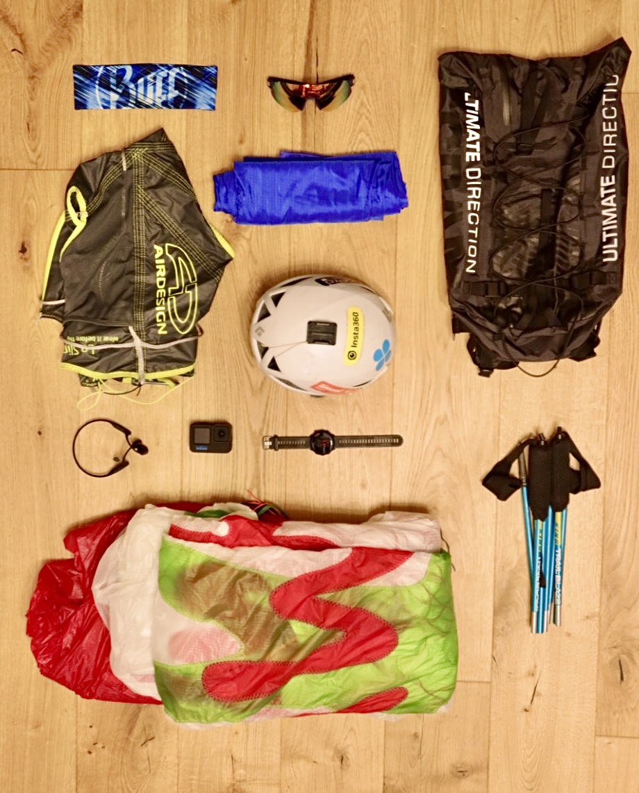
Starting at the feet, I used the Inov-8 Parkclaw 260 Knit shoe. As much as I loathe Inov-8’s desire to keep whitewashing ultrarunning, I do have particularly wide feet so needs must. As a medium term review for these shoes, I wouldn’t recommend them based upon the sole disintegrating after only 8 moderate trail runs.
There isn’t much to say about the clothing system as it proved to be so hot that I only ever flew in shorts and a t-shirt, so my handmade flight wind trousers sadly never made an appearance…
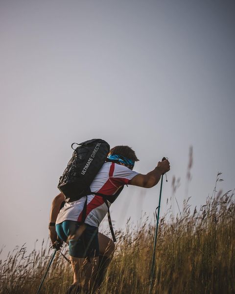
For the backpack I used the Ultimate Direction SCRAM bag. Whilst it’s another bag to add to an ever-growing collection it’s by far the most versatile bag I own. I’ve run with it fully loaded, climbed with it, flown thousands of vertical meters with it, and throughout it has been like a silent partner going everywhere with me and carrying everything I needed for the entire trip. I can’t recommend this bag highly enough if you combine the fast and light approach with multiple sports.
The last piece of running gear were the Sungod Ultras. I’m an ambassador for Sungod so these arrived free for my project, but I think after using and abusing them over thousands of km’s and across an entire continental mountain chain I can give a little feedback. The benefits of the Ultras are how light they are. They feel weightless on the face and the coverage while running in the sun is superb. The customisable nose pieces were incredibly useful, as is the ability to change lenses on the fly. The compromise comes with durability vs. weight – for pure running these are absolutely fine, but when being stuffed in rucksacks and enduring the harsh treatment that comes with hike and fly, I worry that they are very light. The upside is that the glasses come with a lifetime guarantee, so I guess my concerns are taken care of.
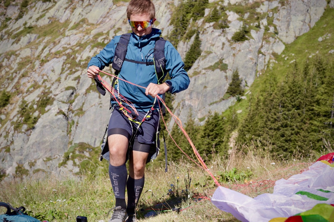
The flying equipment was where I felt I made real compromises. I knew I needed a wing that was light enough to run with, performant enough to cope with true alpine conditions, and rugged enough to cope with that same harsh hike and fly treatment I put the Ultras through. Until this year though that wing simply didn’t exist. I knew I needed a single skin paraglider as it just wouldn’t be possible to run with the bulk of a traditional double skin even in the smallest sizes. But the only options were the Dudek Run and Fly at one end of the spectrum, and a host of other gliders such as the AD UFO and Niviuk Skin 3P at the other.
The Dudek wing is light, absolutely perfect for running with, but it lacks almost all the other characteristics I needed. It lacks the long term durability for sure, but crucially it’s slow and in a headwind it lacks the penetration needed to make safe landing options. At the other end of the spectrum, those wings are higher performing but they achieve that with much higher bulk and weight which would make running a mostly miserable experience.
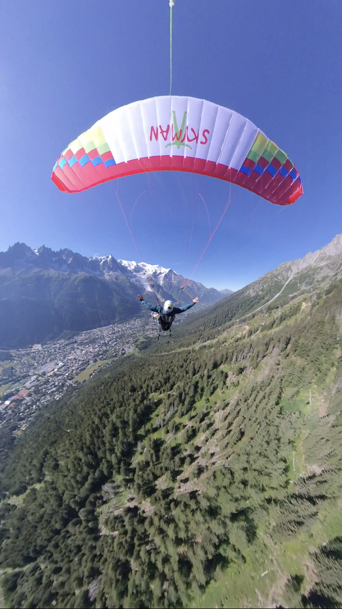
I was edging toward the Skyman Running Edmund because it almost hit all the targets, but then Skyman told me about a new wing they were working on; the Skyman Speed. This is the most innovative single skin I’ve seen to date. It’s a 2-liner so it’s good through the air, it’s stable, it’s very fast for a single skin (hence the name), and whilst being very light it’s made of cloth just heavy enough to stand up to rough treatment at unknown launches.
Having used this wing intensively for a couple of months I’d rank it as one of the most fun wings I’ve flown, almost the easiest to launch (let down by longer lines that are tricky to manage on a small rocky take-off), and by far the best wing I could have hoped to have for this trip. I wouldn’t run and fly with anything else currently available.
The harness I chose was the AirDesign Le Slip – by far the lightest harness I’ve flown (even lighter than my previous Skyman String), and easily the most packable – it folds completely flat so is perfect for fitting in a small bag. It great too, even for longer flights.
The last mention is for the Skywalk Tapa X-Alps reserve. Despite the slight weight increase and added bulk, I never considered running this project without a reserve. Perhaps if I was racing where every gram and second counted then I might consider not taking one, but for this trip as soon as I heard that the Tapa was being released as one of the lightest reserves the decision to carry one became a no brainer.
What is Run and Fly
Before talking about how to train for this project, I first need to describe what it actually is. I’ve given the basic premise above; to run up hill with a wing and then fly back down. But what about when you can’t run up a hill? Many of the hills on this project are very steep, they’re the sort of hills that are often quicker to walk than run. The vertical KM in Chamonix was one of my targets for this project, and as runs go, it’s very steep (there are sections of 45% and steeper), but for this project it was nowhere near the steepest slope I intended to ‘run’ up. So my question in designing this project was to define what counts.
Without going into any more depth than necessary, I determined that run and fly is running on downhill, flat and slightly uphill sections, and then ‘power walking’ any hills that were too steep to run, i.e. if you can’t run them, then walk as fast as you can. The differentiating point with run and fly and hike and fly is that with hiking there is an emphasis on walking for the full distance. With run and fly the emphasis is on moving as fast as possible which is usually running, but clearly it’s not possible to run up every gradient. As a rule of thumb, if you’re going around 1.5x faster than the hiking signs are estimating, you can count your effort firmly in the run and fly category!
Training
In order to train for the Alps run and fly, I was limited to the UK thanks to the good folk who thought voting to restrict their own freedom of movement was an anti-immigration brainwave.
This didn’t prove too troublesome, particularly for the running training. The UK has plenty of steep hills which would give ample practice for what I intended to do in the Alps. These hills also provided some truly horrific weather which I thought would set me up well for any adverse conditions I might face on the continent.
My training therefore featured a variety of distance runs at home on flatter terrain which I complemented in the hills with as much elevation gain as I could. Typically this meant running up to 2 hours on moderate ground, and up to 3 or 4 hours in the mountains. Other than adding lots of stretching and some climbing strength work, I did very little else to prepare for the running.
I did experiment with nutrition on the runs, but invariably my runs in the Alps would be short enough to mostly forgo eating any food on the way up, instead saving as much pack space as I could for water.
As for flight training there’s far too much to cover here, but specifically for this project, I did plenty of flights on the new wing, a crucial step before taking it somewhere big like the Alps. I also trialled a few different tactics, mostly focussed on packing the wing for the running bag and being efficient on launch. I considered leaving the wing attached to the harness after each flight, but eventually realised it was faster to detach the harness and focus on folding the wing and risers consistently.
So by the time I left the UK, I was about as prepared as it was possible to be for a relatively large step into the unknown. I’d be flying in a country I’d previously not visited and taking on so many variables that it was impossible to train for every scenario that might occur. Therefore, with everything considered, I was ready.
Run and Fly the Alps
Instead of talking too much about each individual day, I will instead give a brief overview of what the project achieved, and then take a more analytical approach about the successes and challenges of the trip as I feel this is the most benefit I can provide anyone wanting to do a similar voyage; a reward for reading so far!
Mountains Flown
Slovenia:
Goli VHR South ridge launch, 1787m (RandF)
Goli VHR West face launch, 1787m (RandF)
Austria:
kanzelhöhe, Annenheim, 1524m (R)
Wallackhaus, Grossglockner, 2300m (RandF)
Hochstein, Lienz, 2057m (R)
Gschwandtkopf, Seefeld, 1495m (R)
Italy:
Monte Faloria, Cortina, 2123m (RandF)
Flatschspitz – Cima Vallaccia, 2566m (RandF)
Switzerland:
La Palette, Les Diablerets, 2170m (RandF)
Les Ruinettes, verbier, 2300m (R)
France:
l’Index (via ferrata), Chamonix, 2400m (RandF)
Planpraz (vertical kilometre), Chamonix, 2000m (RandF)
Aiguille de Varan, Passy, 2544m (RandF)
Mont Chéry, Les Gets, 1826m (RandF)
Montmin, Annecy, 1280m (RandF)
Total Stats:
Vertical meters run up: 14,705m
Miles run: 67.2
Vertical meters paraglided down: 10,105m
Vertical meters run down: 3,746m
Learnings
What went well
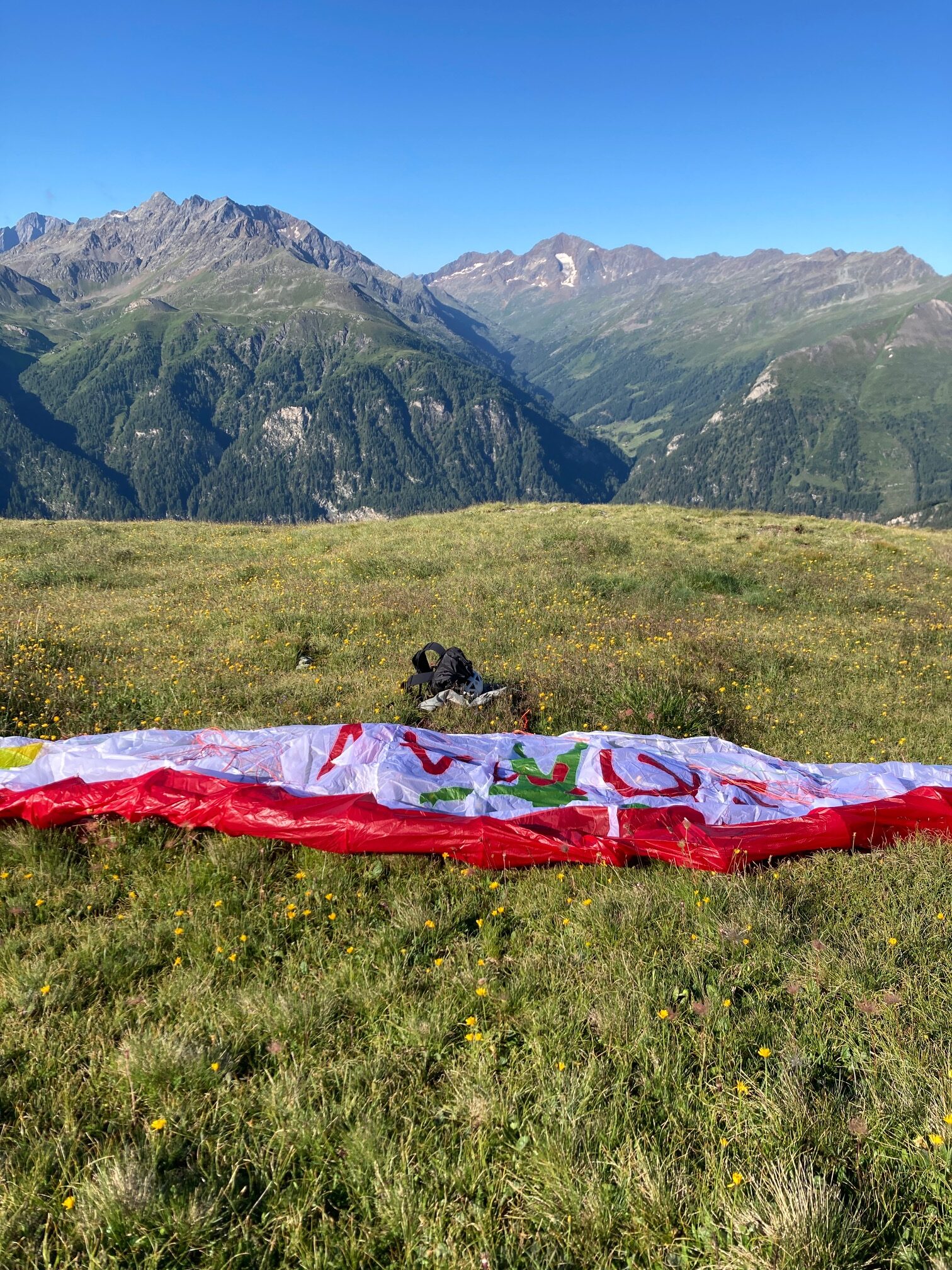
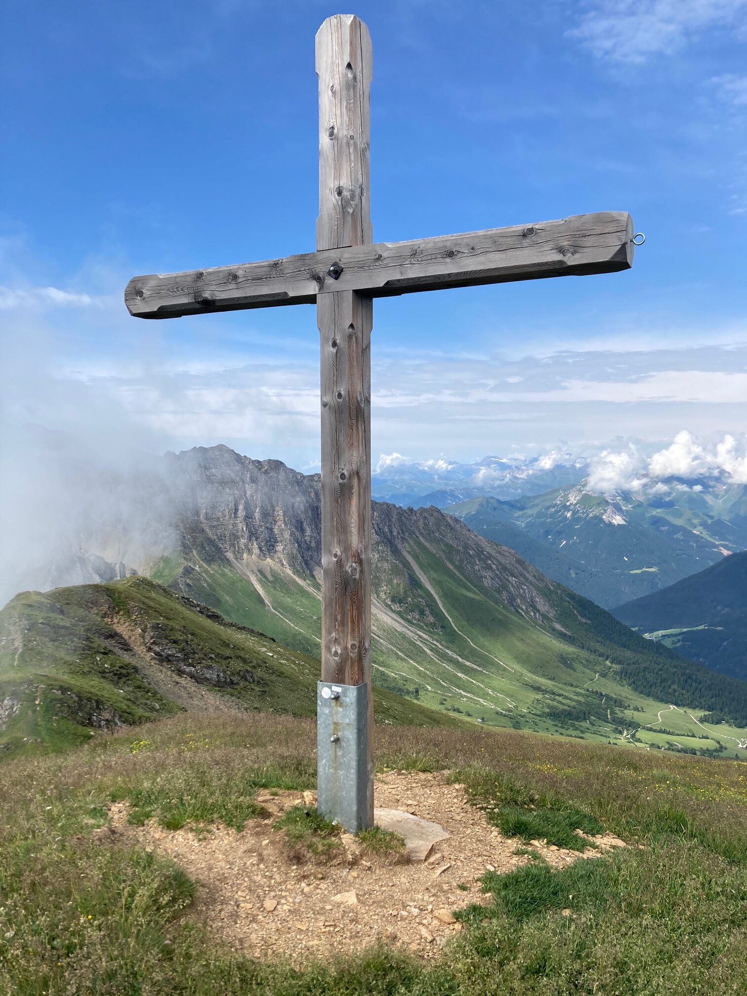
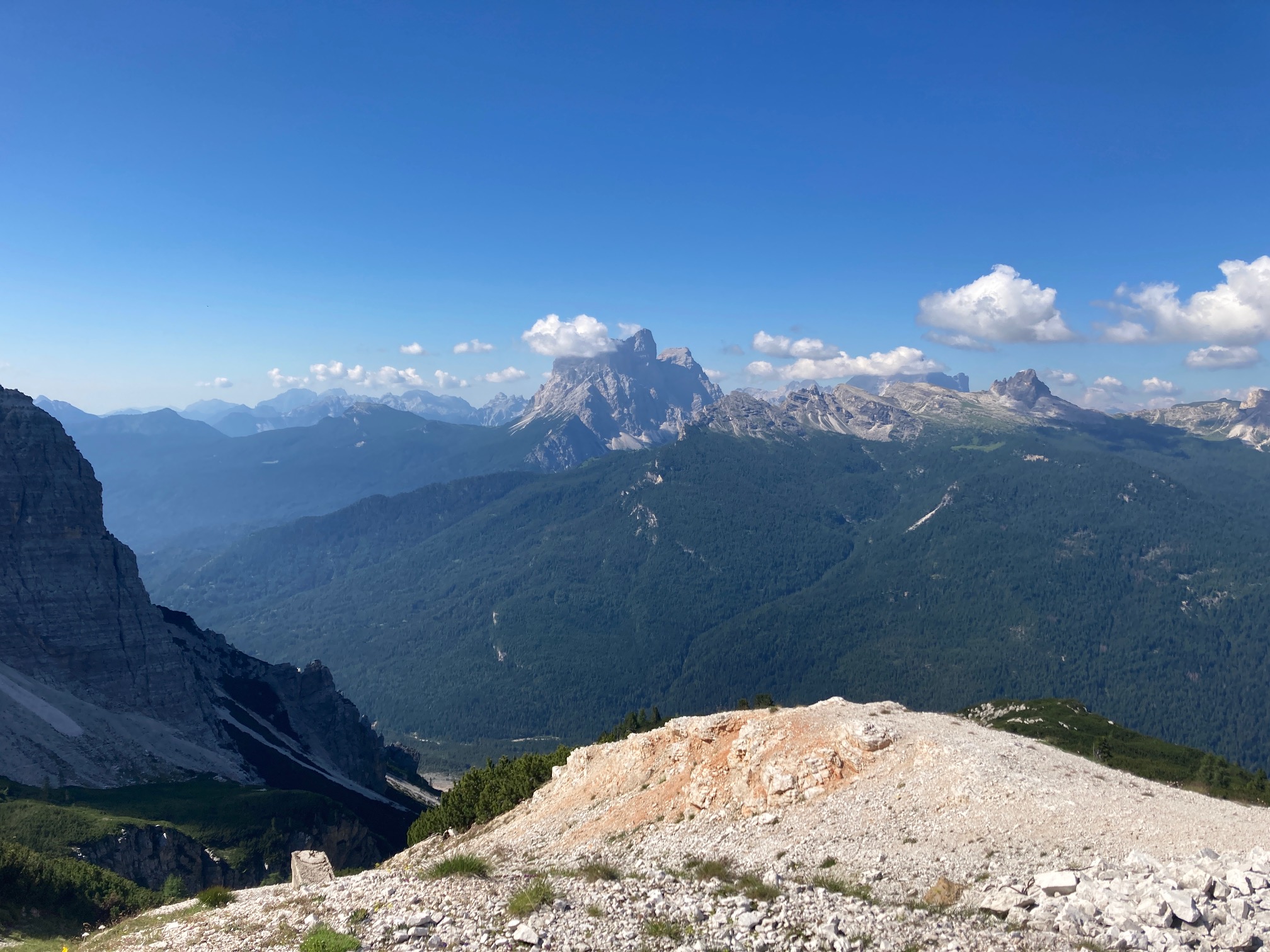
Whilst training for this project, I was less apprehensive than usual and instead quite excited about the prospect to fly in some amazing places. My excitement turned out to be more than justified by the incredible positions I found myself either running or flying in. Having never flown in or even been to Slovenia before, I had no gauge on what the country, terrain or people would be like, other than the various Google searches I made before I arrived. The flights I made from Goli VHR were some of my favourites. It was relatively isolated, quiet and in some ways the perfect run and fly. The run up was 700m vertical, and it happened to be at the perfect angle where running and power walking was possible, but not too steep that progress was hard fought. As the run concluded, the path brought you out onto the summit ridge which immediately gave superb views across Slovenia and southern Austria. I initially thought it wouldn’t be possible to fly from the summit given how narrow the ridge was, but with some creativity, I laid the wing over a clump of nettles and then launched along the summit ridge until the ground dropped away underneath me. Beyond Slovenia, there were Austrian and Swiss meadows, gigantic rock formations of the Dolomites, and breath-taking glaciers hanging below 4,000m peaks as we travelled into France. Despite having spent long periods of time living in the Alps I was certainly taken aback by the sheer scale and contrast of the mountainous areas which doesn’t really come across from maps alone.
I have some pride in completing this project because it turned out to be far harder than I anticipated. The weather played a huge role in the difficulty of the challenge and despite starting the runs between 6 and 7am each morning, it was difficult not to succumb to heat stroke. Combining this heat and the sheer remoteness of many of the initial mountains, the difficulty becomes a huge collection of challenges that need to be rationalised and solved in order to successfully complete each day.
The route we took through the Alps was a mostly obvious one. It could be far better given more time, but with the objective of crossing the Alps in a reasonable number of days, our route gave us the best of both worlds – speed across the mountains whilst still providing magnificent vistas that were good reminders of why we love this place.
Perhaps the biggest surprises of the project was that it was successful! On the surface the task sounds easy, but back-to-back days of big climbing over multiple new locations that have only been scouted on Google Maps and Komoot made the challenge seem harder each successive day. There doesn’t seem to be too many people doing actual run and flys, i.e. running vs hiking. So by completing this project, I hope this helps run and fly to become a little more popular, not just using single skins in the big mountains, but for the everyday run up and save the legs on the way down; the reason so many people started paragliding.
My final point in this section is a combination of success and challenge that is certainly a point of learning. As I previously mentioned, I was attempting this project in conjunction with my partner who was challenging herself with an attempt to cycle between 6 of the main glaciers of the Alps and record the conditions when she got there. The combination of both our separate projects at the same time is certainly unique, but it did offer difficulties and also wonderful motivation when the going was quite tough. A short summary of the difficulties would include the fact that two very tired people will struggle to find water, do the shopping, find suitable parking areas and generally recover compared with one very tired person and one well rested one. It’s very difficult to know how you will react when you’re a week into an exhausting project and the conditions are much more challenging than you could have prepared for. If you add into the mix that our accommodation was a very small van (small for one person, laughably so for two), you can begin to appreciate that we did well to survive the experience.
In contrast to this aspect, whilst I wouldn’t recommend that couples rush headlong into separate challenges whilst living in extremely close quarters, there are definite advantages to this approach. On a practical level, we could both attempt our objectives in a short time scale, and it’s more carbon intensive to make the same journey twice. But on a more emotional level, there is a definite motivational advantage to be gained when you are following your partners extremely difficult journey whilst attempting one of your own. It gives you a purpose to reach the end goal for the day (not least because there’s only one van between you, and it’s probably a long way away from the cyclist!), and it also lifts you when you have set backs. It’s proved so worthwhile to be able to ask how the other person was coping in the heat under different circumstances, and to be able to rationalise what the best strategies were for coping with the heat.
In short, certainly a relationship testing situation, but one that can really forge you together when the going gets tough.
What was difficult/challenges
I think this section will be the most informative for those interested in starting out or considering run and fly objectives.
The Running
It sounds obvious to point out, but one of the largest challenges was the continual running! Almost every run featured around 1,000m of elevation gain. This is relatively significant for a single run but doing this on consecutive days is tough. Add in the weight of the kit (which despite being ultralight for paragliding still weighs around 5kgs) and the project becomes a war of attrition.
The Weather
Part of the reason the runs were so difficult is that I generally chose the steepest most direct lines. I chose July and August for this project and although I expected heat, I didn’t anticipate the 40oC temperatures that came over multiple heatwaves. This heat was almost unbearable to run in by 9am even in the higher mountains. So this meant starting early and going as quickly as possible to beat the heat. It’s difficult to describe how debilitating the heat has been but even when finishing by 10am, heatstroke was hard to avoid.
The Treeline
Climbing above the treeline was something I didn’t particularly consider given that trees don’t feature much on UK mountains. In many areas of the Alps however, trees dominate the hills to the point where it’s just not possible to launch in many places. Even if there is a clearing on Google Maps, the trees below the clearing may still be too tall making launch impractical. What this translated to is always running above the treeline. I did this on every mountain and it just added to the effort because even if I felt like the sun was too strong or I didn’t have the energy to continue running uphill, there was rarely any opportunity to just fly back to the valley until that line had been crossed.
New Sites
On almost every day, the site was new. This added so many challenges to mentally process while scoping out possible flying areas and during the runs. It didn’t help that I was doing the project solo, where every decision was made and ultimately owned by me.
A typical run would include observations of the windspeed and wind direction, scoping out the landing field before running and then finding emergency landing sites mid run in case the valley winds picked up too much while I was flying and I was forced to land mid slope (this happened once, it was very scary, I’m glad I scoped out 3 alternative landing sites!). Even before running I needed to know how much food and water to take, whether there was likely to be any water enroute and often how far the run back to the van would be once I’d flown. Once at the launch spot, making a personal assessment (you’ve just spent the past 2 hours running 1,500m vertical so you might be tired!) and then a complete weather assessment. How thermic does it look and feel, what are the clouds doing, is the wind in the valley and on the summit blowing the same way, can I comfortably clear the launch area, and most importantly, can I make the intended landing? This last one was a headache on multiple flights, it involves calculating the direct glide slope from the launch to landing and ensuring the wing can fly at least that glide ratio; then factoring in the conditions – a headwind will cause penetration issues and my glide ratio will drop. The launch itself needs to be considered; does it go? It’s very different looking at Google Street View at valley level vs. standing on the edge of a cliff with the wing fluttering behind you in the morning breeze. Finally, it’s the morning so are clouds going to be an issue; what happens if the landing site clouds over beneath you while you’re in the air? And have you seen the power lines? Power lines are easy to see on the ground, but somewhere between difficult and impossible once flying; flight instructors often say it’s worth taking almost any course of action to avoid hitting power lines even crashing into difficult terrain, so it’s worth making sure you know exactly where they are before launching out into the abyss!
This list is not exhaustive but gives a good idea what the thought processes are. In short, once you’ve spent 2 hours running up hill and you stand on the narrow summit edge, you need to be clear about what happens next and make the right choices.
Wind speed
Wind is one of the biggest enemies of single skin wings. They can easily soak up strong thermals but with an increasing valley wind (a common occurrence in narrow alpine valleys) single skins can get stuck (pinned) or in the worst case pushed back. Even the Skyman Speed with its trim speed of around 45km/h is no match for big alpine winds and getting caught out is a scary prospect. This made weather forecasting a big headache as there are very few reliable options that forecast wind speed across the whole Alps and at all elevations. Mountain Forecast gave a general overview, but certainly wasn’t reliable as a standalone report.
This was most notable while flying from Flatschspitz – Cima Vallaccia in Italy. After one of the biggest runs of the project, I felt relatively light but certainly strengthening winds on the summit. I launched quickly into messy air and gradually worked down to the treeline. Once over the narrow valley that funnels wind between Austria and Italy, the wind speed dramatically increased and I became effectively pinned. The forecasted windspeed was 5kph, but this certainly wasn’t the case in reality. After a rapid identification of hazards, I realised that going further into the valley between high tension power lines wasn’t a wise move, so instead I lined up a tiny patch of grass surrounded by trees on the hillside below me. I was almost stationary in the air, the slightest touch of brakes sent me backwards at a considerable ground speed. Trying not to panic, I hovered over the landing field and used a combination of brakes and hands up to do a vertical landing. I lined up the field perfectly however once under tree height the dreaded rotor than was now piling over the trees in front of me gave me an instantaneous tail wind and I rushed toward the ground. The wing handled this beautifully and I skidded to a halt just before the bordering trees. I was unscathed but came away with a big lesson – winds in narrow valleys are unpredictable and despite the forecast, the largest margin of error is needed, particularly with a single skin.
The Journey Across Europe
During this project, the run and fly accounted for less than half the time each day. Starting by 7am, I’d finish by 10am with a further 12 hours to use before sleeping. We tried to spend this time wisely, by finding water, restocking food, making our way to the next site and generally recovering. In some respects this was the hardest part of the project, not least because of the heat. Despite the great weather for (very) early morning flying, I would struggle to recommend anyone does a lengthy run and fly project in July when late August/early September can offer the same settled conditions at a fraction of the temperature. When getting back to the van at 10am, the temperature inside (even with window covers) was over 30oC. By 12pm, the temperature would be closer to 40oC and would stay that way until late into the evening. Sleeping at over 28oC for weeks at a time after high output exercise during the day is no way to recover. This heat induced fatigue meant that even after finishing what should have been the hardest part of the day, in reality there was no rest. This was compounded by the difficulty of finding water in some places. In France it is particularly easy to refill the van water supply, but in some parts of Austria and Italy, we found it very difficult to either find or trust water sources. Occasionally we resorted to buying bottled water which whilst annoying and doing nothing to minimise our impact, provided a great distraction between still and sparkling water. In eastern Austria particularly, it was often impossible to buy still water with the choice instead being the various ‘grades’ of sparking water available – another terrible recovery technique.
Sticking with the van for the final point, parking was an inevitable cause of stress. In some areas parking was easy and it was possible to park directly at the start of our intended routes. But as we travelled west, especially once we reached Switzerland, parking became more and more scarce and less and less tolerated. It seems in Switzerland there is a very strong anti vanlife sentiment to the point where drivers will actively inconvenience themselves and other drivers just to ‘beep’ at vans stopped in parking areas. This made finding suitable flying sites in Switzerland very difficult and was certainly a factor in choosing more Austrian and French mountains from which to fly.
The reason for mentioning these van related issues is that this project is primarily a ‘transiting through’ project. It’s not based in one place and relies upon easy travel between sites. After a hard run and fly, the last thing you want is to be struggling with water or parking, jeopardising your recovery and starting the next day with more exhaustion than necessary. Due to this, the planning of the project (which was relatively meticulous) can only go so far, and a recce of the entire route would probably make the entire project 10x easier than an ‘on sight’ attempt.
Conclusion
Whilst one of the more fun challenges I’ve set myself, this one really pushed me in so many ways, right from the drive to get to Slovenia and the very first launch along a narrow alpine ridge.
During this project, I changed to some small degree what I thought run and fly was. I started with the assumption that any uphill movement would be through running, however the run and fly ethos is also about moving quickly with superlight equipment. What this means is that you no longer need to choose manageable paths, you can combine many elements such as running, scrambling, via ferrata etc, and move uphill on routes that aren’t quite runnable, but are certainly much faster than walking. I also changed my views on whether I felt I had achieved a run and fly if I wasn’t able to fly back down. I flew from the majority of mountains, but there were a number where the weather conditions just weren’t safe and I was left with the only viable option – to run back down. I realised that this is where run and fly excels. On one hand, you have a paraglider that isn’t quite as good at handling strong winds or thermals, but instead you have such light equipment, running back down with it is almost as enjoyable as the flight. So instead of worrying about the flight back down when you’re spending lots of effort running up hill in very marginal conditions, I think run and fly is about the intention to go as fast as possible and to get back down via the best way possible; it doesn’t quite matter how you move, just make it quick and fun.
I’m excited to see where else I can take the run and fly principle. In the future, I’ll be aiming for similar projects, but maybe also incorporating a little less running and more climbing; with the single skin wing technology improving every year, I think we’re certainly at a point where paragliding and alpinism mesh together really well. The obvious issue for that is the same challenge that was ever-present on this journey, the heat. The summer of 2022 has been steady stream of stark warnings, from the collapse of the Marmolada glacier to the continual rockfall that is occurring at ever higher elevations across the Alps. Travelling across the Alps has been a stark reminder about what is happening, and to some extent, highlighting the hopelessness of the situation. Without trying to end on a bleak note, it’s hard not to be upset and angered by the change in the alpine environment. It is upsetting to know what most major glaciers in the Alps will be effectively gone by 2050; by 2100 the Alps will be entirely changed and traditional Alpinism won’t really exist. It’s angering to know that nothing can really be done to slow down this extreme change in climate, and what little can be done is being overwhelmingly ignored by governments.
So for future projects, everything needs to be on the table. Flexibility will continue to be more and more important in the mountains and while run and fly/climb and fly/hike and fly and vol biv are perfect combinations for changeable situations, it is important to remember that this is because of the demands of climate change just as much as it is about an enjoyable choice.
If nothing else, thank you for following me on this small journey. I hope you have enjoyed the updates which have perhaps piqued your interest in run and fly, and ultimately I hope this helps to bring this niche a little closer to those with a desire to travel fast and fly high.